The ionosphere has a major impact on the signal transmission space-to-ground and ground-to-space. Normally in GNSS processing, thanks to the dual- (or multiple) frequency nature of the signals, the major contribution of the ionosphere can be eliminated, while for other applications (e.g., deep space navigation as done by the colleagues of Flight Dynamics) this correction shall be known and applied.
As GNSS signals are affected by the ionosphere delaying effects on the signals, they can and are used to determine the ionosphere Total Electron Content, in a single-layer approach and in a 3D-approach, based on multi-GNSS constellations processing and with an extended station network.
The Navigation Support Office at ESA / ESOC routinely computes precise ionospheric products covering a 24-hour period, in IONEX format, which are described here under the Ionosphere Map products category, and published with the following latencies:
-
ULTRA, 34-10 hours delay, with 1-hour-maps: ESA0OPSRAP_YYYYDDD0000_01D_01H_GIM.INX
-
ULTRA, 34-10 hours delay, with 2-hours-maps: ESA0OPSRAP_YYYYDDD0000_01D_02H_GIM.INX
-
FINAL, 4 days delay, with 2-hours-maps: ESA0OPSRAP_YYYYDDD0000_01D_02H_GIM.INX
This page provides 24-hour animations of the most recent ESA IONEX products.
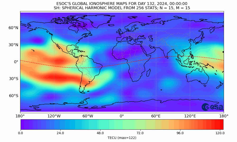
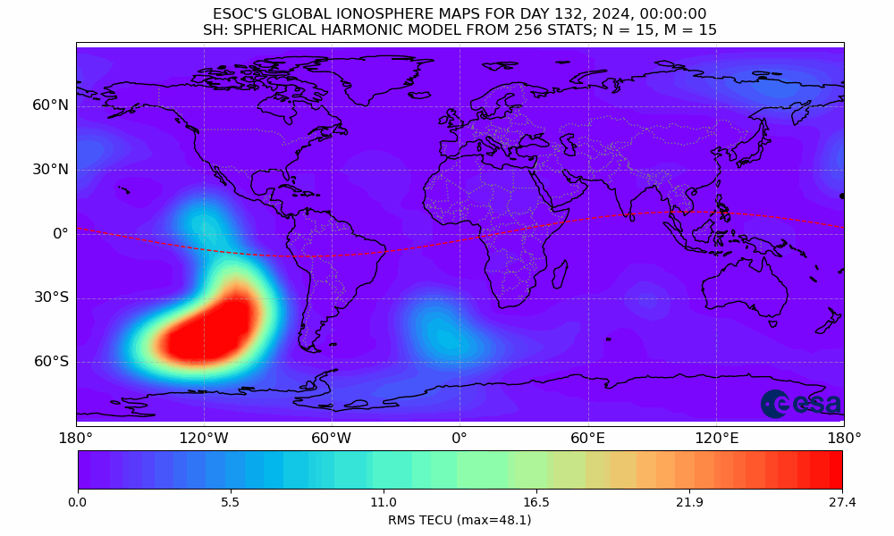
TEC Map and RMS TEC Map from the ULTRA 1-h product, additionally showing the sub-solar point (black dot) and geomagnetic equator (red dashed line)
A full history of these animations, including the most recent files displayed on this page, is available here .